Trail heads: GWT ( 0.85 miles up from The Altar, 40.34844° N 111.64946° W), Dry Canyon (0.7 miles from trail head, 40.34847° N 111.66825° W).
Distance: 1.9 miles.
Intersecting trails: Lament (1.15 miles from Dry Canyon).
Description: Designated by the Forrest Service (with carsonite signs) as trail 051, hence the nickname Area 51. Connects between the Dry Canyon trail and the Great Western Trail (GWT). Most often this trail is reached by climbing Lament. If starting at Dry Canyon it's a tough climb up to the trail head, then a few steep pitches up Area 51 before it relents and rolls over to the intersction of Lament. Continuing east past Lament is more steep climbs but with some breaks and a fun downhill to the GWT. It's possible to climb the GWT and ride Area 51 east to west, but the GWT is steep and loaded with loose rock - however once on Area 51 it should be easier going.
Photos:
[Need photos]
Showing posts with label trails. Show all posts
Showing posts with label trails. Show all posts

Firing Range trail
Trail heads: Start of Orem BST and Water Tank road (40.32518° N 111.66944° W), Crank (0.65 miles from Betty, 40.33328° N 111.66081° W).
Distance: 1.0 miles.
Intersecting trails: Ireland (0.7 miles up from Water Tank road).
Description: Drops off the front (west) side and ends just below the police firing range near the trail head for the Orem BST and the start of the Water Tank road. Quite steep in spots often with loose rock which may spook beginners, but not difficult with intermediate skills. This trail would be a steep and tough climb.
Photos:
[Need photos]
Distance: 1.0 miles.
Intersecting trails: Ireland (0.7 miles up from Water Tank road).
Description: Drops off the front (west) side and ends just below the police firing range near the trail head for the Orem BST and the start of the Water Tank road. Quite steep in spots often with loose rock which may spook beginners, but not difficult with intermediate skills. This trail would be a steep and tough climb.
Photos:
[Need photos]
Ireland trail
Trail heads: Water Tank road (0.7 miles up the road, 40.32390° N 111.65856° W), Crank (0.9 miles from Betty or 0.4 miles down from Lament, 40.33708° N 111.66221° W).
Distance: 1.0 miles.
Intersecting trails: Firing Range (0.7 miles from Water Tank road).
Description: Named Ireland because of the sea of green grass you ride through in the Spring. A nice downhill trail with lots of speed and sweeping turns. It can be climbed, but it's tough and unrelenting.
Photos:
[Need photos]
Distance: 1.0 miles.
Intersecting trails: Firing Range (0.7 miles from Water Tank road).
Description: Named Ireland because of the sea of green grass you ride through in the Spring. A nice downhill trail with lots of speed and sweeping turns. It can be climbed, but it's tough and unrelenting.
Photos:
[Need photos]
Roller Coaster trail
Trail heads: The Water Tank road (0.8 miles up the road, 40.32358° N 111.65708° W), Betty (0.4 miles from Water Tank road, 40.33493° N 111.65484° W).
Distance: 0.8 miles.
Intersecting trails: None.
Description: Named Roller Coaster because of the undulating, rolling terrain that on a bike feels like an amusement park ride. Most common to ride down (north to south), but can go up - if you can make the steep initial climb the rest is easier.
Photos:
[Need photos]
Distance: 0.8 miles.
Intersecting trails: None.
Description: Named Roller Coaster because of the undulating, rolling terrain that on a bike feels like an amusement park ride. Most common to ride down (north to south), but can go up - if you can make the steep initial climb the rest is easier.
Photos:
[Need photos]
Lament trail
Trail heads: The Altar (intersection with Betty, Frank and GWT, 40.34400° N 111.65099° W), Area 51 (1.1 miles from Dry Canyon, 40.34384° N 111.65986° W).
Distance: 0.9 miles.
Intersecting trails: Crank (0.7 miles from the Altar).
Description: Full name is Betty's Lament. From the Altar the trail heads west climbing mildly through meadows then climbs several steep pitches in the until cresting a ridge to gain views of Utah Valley. From here the trail rolls along, passes Crank then turns north to Tee with Area 51 - left goes to Dry Canyon, right goes to the GWT (which can be descended back to the Altar).
Photos:
[Need photos]
Distance: 0.9 miles.
Intersecting trails: Crank (0.7 miles from the Altar).
Description: Full name is Betty's Lament. From the Altar the trail heads west climbing mildly through meadows then climbs several steep pitches in the until cresting a ridge to gain views of Utah Valley. From here the trail rolls along, passes Crank then turns north to Tee with Area 51 - left goes to Dry Canyon, right goes to the GWT (which can be descended back to the Altar).
Photos:
[Need photos]
Crank trail
Trail heads: Betty (0.4 miles up from Water Tank Road, 40.33547° N 111.65508° W), Lament (0.7 miles from the Altar, 40.34167° N 111.66034° W).
Distance: 1.3 miles.
Intersecting trails: Ireland, Firing Range.
Description: The Crank turn off is marked with a small rock Cairn. It will be a left hand turn if you are climbing Betty. The trail is normally ridden as a climb, but can be descended as well. The trail winds, contours and traverses through hollows, meadows and along a ridge until it meets Betty's Lament.
A time trial route has been setup on Crank - see the Crank TT website for more info.
Photos:
[Need photos]
Distance: 1.3 miles.
Intersecting trails: Ireland, Firing Range.
Description: The Crank turn off is marked with a small rock Cairn. It will be a left hand turn if you are climbing Betty. The trail is normally ridden as a climb, but can be descended as well. The trail winds, contours and traverses through hollows, meadows and along a ridge until it meets Betty's Lament.
A time trial route has been setup on Crank - see the Crank TT website for more info.
Photos:
[Need photos]
Race Course trail
Trail heads: Timpanogos Park (40.32551° N 111.64497° W).
Distance: 2.0 miles.
Intersecting trails: Cliff, Alta Aqueduct Road, Connector to Water Tank Road [we need a name for this trail - in fact there are two trail that go up to the road].
Description: From the parking lot of Timpanogos Park, go through the metal gate at the north west corner then after a few yards take the dirt road to the right and pass by another metal gate. Climb the gravel road past a left and then a right turn (switchback) then veer left past another metal gate and follow as the road turns left. After a stand of scrub oak, make a left turn onto a double track which turns into a trail then descends into a gully and traverses back up the other side. Here most riders make a sharp right turn and start climbing up the race course. Wind your way up the slope staying on the most worn trail. The trail eventually stops climbing and starts descending - one slope is quite steep and sketchy which may be spooky for novice and even some intermediate riders. The trail descends a little farther then climbs a bit to cross a small gully then meets back at the sharp right turn.
At the top of the Race Course a trail keep climbing up then forks with each trail reaching the Water Tank road. The left fork is steep but can be climbed on a bike - it joins the road near the start of the Betty trail. The right fork climbs moderately at first then gets steeper until the last 10 yards to the road where most will push their bike up.
Photos:
[Need photos]
Distance: 2.0 miles.
Intersecting trails: Cliff, Alta Aqueduct Road, Connector to Water Tank Road [we need a name for this trail - in fact there are two trail that go up to the road].
Description: From the parking lot of Timpanogos Park, go through the metal gate at the north west corner then after a few yards take the dirt road to the right and pass by another metal gate. Climb the gravel road past a left and then a right turn (switchback) then veer left past another metal gate and follow as the road turns left. After a stand of scrub oak, make a left turn onto a double track which turns into a trail then descends into a gully and traverses back up the other side. Here most riders make a sharp right turn and start climbing up the race course. Wind your way up the slope staying on the most worn trail. The trail eventually stops climbing and starts descending - one slope is quite steep and sketchy which may be spooky for novice and even some intermediate riders. The trail descends a little farther then climbs a bit to cross a small gully then meets back at the sharp right turn.
At the top of the Race Course a trail keep climbing up then forks with each trail reaching the Water Tank road. The left fork is steep but can be climbed on a bike - it joins the road near the start of the Betty trail. The right fork climbs moderately at first then gets steeper until the last 10 yards to the road where most will push their bike up.
Photos:
[Need photos]
Betty trail
Trail heads: Water Tank Road (1.4 miles up from parking lot, 40.33636° N 111.64243° W), The Altar (intersection with Frank, Lament and GWT, 40.34400° N 111.65099° W).
Distance: 1.1 miles.
Intersecting trails: Roller Coaster, Crank.
Description: After leaving the Water Tank Road, the trail climbs steeply for 1/4 mile then relents for a 1/2 mile then climbs more steeply to The Altar. Betty is a tough climb but fun downhill. The middle part usually has patches of loose rock.
Photos:
The Altar as seen coming up Betty - Frank is to the right, Betty's Lament to the left, GWT straight. [Better to have a photo of the Altar looking up Frank]
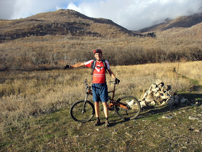
On Water Tank road looking east with Betty trail forking left.
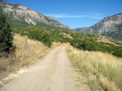
Distance: 1.1 miles.
Intersecting trails: Roller Coaster, Crank.
Description: After leaving the Water Tank Road, the trail climbs steeply for 1/4 mile then relents for a 1/2 mile then climbs more steeply to The Altar. Betty is a tough climb but fun downhill. The middle part usually has patches of loose rock.
Photos:
The Altar as seen coming up Betty - Frank is to the right, Betty's Lament to the left, GWT straight. [Better to have a photo of the Altar looking up Frank]
On Water Tank road looking east with Betty trail forking left.
Frank trail
Trail heads: Water Tank Road (2.8 miles up from parking lot, 40.33636° N 111.64243° W), The Altar (intersection with Betty, Lament and GWT, 40.34400° N 111.65099° W).
Distance: 0.8 miles.
Intersecting trails: none.
Description: After leaving the Water Tank Road, the trail climbs steeply and switchbacks for 1/4 mile then relents and climbs more moderately to The Altar. Frank is a tough climb but fun downhill. The lower part usually has patches of loose rock.
Photos:
The Altar as seen coming up Betty - Frank is to the right, Betty's Lament to the left, GWT straight. [Better to have a photo of the Altar looking up Frank]
[Water Tank Trail head]
Distance: 0.8 miles.
Intersecting trails: none.
Description: After leaving the Water Tank Road, the trail climbs steeply and switchbacks for 1/4 mile then relents and climbs more moderately to The Altar. Frank is a tough climb but fun downhill. The lower part usually has patches of loose rock.
Photos:
The Altar as seen coming up Betty - Frank is to the right, Betty's Lament to the left, GWT straight. [Better to have a photo of the Altar looking up Frank]
[Water Tank Trail head]
Dragon's Back trail
Trail heads: Canyon Glen Park (Provo River paved trail by the drinking fountain, 40.33077° N 111.62041° W), end of Water Tank Road by metal gate (40.33551° N 111.63747° W).
Distance: 1.2 miles.
Intersecting trails: Union Aqueduct Road.
Description: After leaving the paved Provo Canyon Parkway trail, Dragon's Back climbs steeply to the north, makes a tight right-hand switchback then gains the Union Aqueduct Road. Go up canyon on the road 10-20 feet then left on the trail as it climbs steeply again. A patch of loose rock can be difficult. Continue on up until the trail flattens out as you enter Johnson's Hole, a small valley. To the left the trail climbs up the rocky ridge, which gives the trail it's name. The trail rolls with steep climbs then flatter sections until you reach the metal gate at the Water Tank Road.
The road down from the gate is the Alta Aqueduct Road which will take you past the Race Course and down to Timpanogos Park.
For more single-track climbing, take the Water Tank road west (down canyon) to the Frank trail.
Photos:
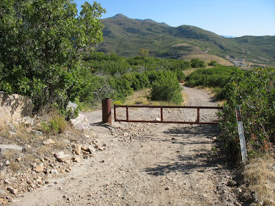
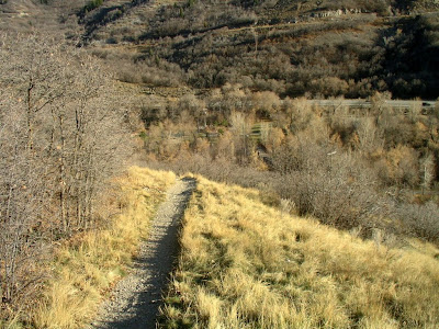
Top of Dragon's Back trail - go around left side of this gate across Alta Aqueduct road just past end of Water Tank road.
Looking down Dragon's Back with Johnson's Hole on the left.
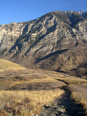
Looking down the trail into Canyon Glen Park below the Union Aqueduct road.
Distance: 1.2 miles.
Intersecting trails: Union Aqueduct Road.
Description: After leaving the paved Provo Canyon Parkway trail, Dragon's Back climbs steeply to the north, makes a tight right-hand switchback then gains the Union Aqueduct Road. Go up canyon on the road 10-20 feet then left on the trail as it climbs steeply again. A patch of loose rock can be difficult. Continue on up until the trail flattens out as you enter Johnson's Hole, a small valley. To the left the trail climbs up the rocky ridge, which gives the trail it's name. The trail rolls with steep climbs then flatter sections until you reach the metal gate at the Water Tank Road.
The road down from the gate is the Alta Aqueduct Road which will take you past the Race Course and down to Timpanogos Park.
For more single-track climbing, take the Water Tank road west (down canyon) to the Frank trail.
Photos:
Top of Dragon's Back trail - go around left side of this gate across Alta Aqueduct road just past end of Water Tank road.
Looking down Dragon's Back with Johnson's Hole on the left.
Looking down the trail into Canyon Glen Park below the Union Aqueduct road.
Cliff trail
Trail heads: Water Tank Road (1.0 miles up from parking lot, 40.32333° N 111.65491° W), Race Course (40.32770° N 111.65360° W).
Distance: 0.5 miles.
Intersecting trails: none.
Description: After leaving the Water Tank Road, the trail descends along the top of an inclined cliff band until it crosses a gully and drops down to join the Race Course trail. It is possible to ride up this trail but it is steep and technical with the exposed sections adding risk.
CAUTION: There are a few places where this trail gets close to the edge of the cliff and a fall over the edge would likely result in injury or death. Watch for these exposed places and walk your bike or go back if the exposure bothers you. If you don't like heights or edges you may not like this trail.
Photos:
[Need photo of Water Tank Road trail head, and junction with Race Course]
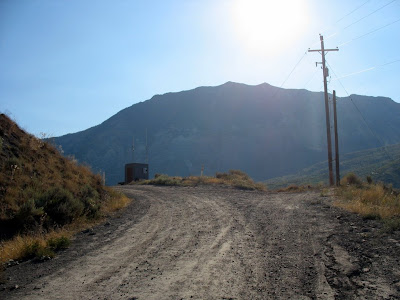
On the Water Tank road looking east up the last climb. At the top the road turns left. The Cliff trail starts straight ahead on the right.
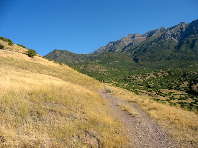
Looking north as the Cliff trail narrows to single track.
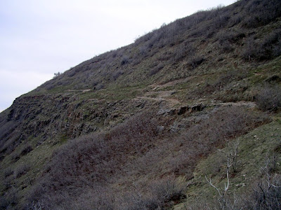
Looking back up the Cliff trail as it travels along the top of the cliff band.
Distance: 0.5 miles.
Intersecting trails: none.
Description: After leaving the Water Tank Road, the trail descends along the top of an inclined cliff band until it crosses a gully and drops down to join the Race Course trail. It is possible to ride up this trail but it is steep and technical with the exposed sections adding risk.
CAUTION: There are a few places where this trail gets close to the edge of the cliff and a fall over the edge would likely result in injury or death. Watch for these exposed places and walk your bike or go back if the exposure bothers you. If you don't like heights or edges you may not like this trail.
Photos:
[Need photo of Water Tank Road trail head, and junction with Race Course]
On the Water Tank road looking east up the last climb. At the top the road turns left. The Cliff trail starts straight ahead on the right.
Looking north as the Cliff trail narrows to single track.
Looking back up the Cliff trail as it travels along the top of the cliff band.
Subscribe to:
Posts (Atom)